When one thinks of Panama, one immediately imagines its paradisiacal beaches, wild islands and lush tropical forests. But the country also has some wonderful surprises in store for hiking enthusiasts. From accessible walks to more technical trails, there’s something for everyone. In this article, we take a look at some of the country’s most beautiful trails, and tell you whether a guide is recommended for each one.
Mountain and volcano treks
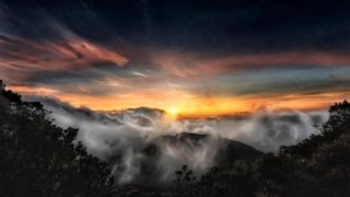
Beyond its coastline and jungle, Panama is also a land of peaks. Climbing Volcán Barú, the country’s highest peak at 3,474 metres, is a mythical adventure: on a clear day, you can see both the Pacific Ocean and the Caribbean Sea from the summit. More accessible but just as enchanting, the Sendero Los Quetzales winds through the cloud forest, linking Boquete to Cerro Punta, with the chance to catch a glimpse of the legendary quetzal. For a shorter hike, India Dormida, in El Valle de Antón, captivates with its legend and unique panorama of an inhabited crater. As for Cerro Picacho and Cerro Chame, on the Pacific coast, they offer sporty walkers spectacular panoramas after a demanding climb. These high-altitude hikes reveal another facet of Panama: wild, grandiose and sometimes unsuspected.
Mountains and volcanoes: technical info
Panama offers many mountain trails to discover cloud forests, volcanic peaks and panoramic views of both oceans. Here is a selection of hikes classified by level of difficulty
Volcán Barú: the mythical ascent
Volcán Barú, Panama’s highest peak at 3,474 metres, is the country’s most demanding ascent. The trail generally starts at night (around midnight) from Boquete, reaching the summit at dawn. The ascent takes between 6 and 8 hours, the descent between 4 and 6 hours. On a clear day, the summit offers a simultaneous view of the Pacific Ocean and the Caribbean Sea, an experience unique in the world. Temperatures at the summit sometimes drop below 0°C. Bring warm clothing, headlamp, water and energy snacks.Level: difficultLocation: Boquete, Chiriquí provinceDuration: 10 to 14 hours round tripGuide: recommended for safety and night orientation
Sendero Los Quetzales: cloud forest crossing
This trail crosses one of Panama’s most beautiful cloud forests, linking Boquete to Cerro Punta. The 6-8 km route winds through lush vegetation, home to the resplendent quetzal, a mythical bird with emerald-green and red feathers. The best time to see the quetzal is from February to May, during the breeding season. Humidity is constant, and the trail can be muddy. Bring waterproof hiking boots and rain gear. The walk takes around 4 to 5 hours at a leisurely pace.Difficulty level: moderateLocation: between Boquete and Cerro Punta, Chiriquí provinceDistance: 6 to 8 kmDuration: 4 to 5 hoursGuide: recommended for orientation and maximizing chances of spotting the quetzal
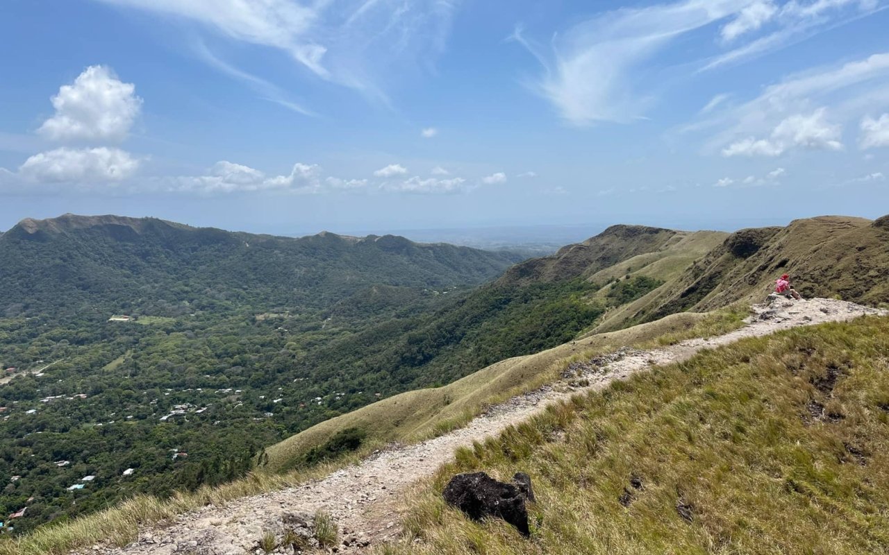
La India Dormida: panoramic view of the El Valle crater
This loop hike offers spectacular views of the inhabited crater of El Valle de Antón, one of the largest inhabited volcanic craters in the world. The well-marked trail climbs steadily to a viewpoint overlooking the entire valley. The name « India Dormida » (Sleeping Indian) derives from the mountain’s silhouette, which, seen from afar, evokes a reclining woman. The hike is suitable for families and can be done early in the morning to avoid the heat. The route passes through a tropical forest before reaching rocky areas with 360-degree panoramic views.Level: easy to moderateLocation: El Valle de Antón, Coclé provinceDistance: 3 to 4 km (loop)Duration: 2 to 3 hoursGuide: not necessary, well-marked trail
Cerro Picacho: short, intense climb
This small summit near San Carlos offers a short but steep climb rewarded by unobstructed views of Lake San Carlos and the Pacific coast. The difference in altitude, concentrated over just 2 kilometers, requires a sustained effort, but the climb is still accessible in 1 to 2 hours. The trail first crosses an agricultural area before climbing more steeply through vegetation. The little-visited summit offers a tranquil panorama ideal for watching the sunset. Leave in the late afternoon to enjoy the golden light over the lake.Level: moderateLocation: San Carlos, Coclé provinceDistance: 2 km round tripTime: 1 to 2 hoursGuide: not necessary
Cerro Chame: demanding trail to the Pacific coast
This little-known hike offers a remarkable panorama of the Pacific coast and surrounding plains. The 4-5 km trail climbs steadily through dry tropical forest to reach the rocky summit, and takes between 3 and 4 hours to complete, depending on your pace. In the rainy season (May to November), the terrain becomes slippery and exposed roots make progress tricky. A local guide knows the technical passages and ensures a safe descent. In the dry season, the trail can be walked on its own with good footwear. Difficultylevel: moderateLocation: Chame, province of Panamá OesteDistance: 4 to 5 kmDuration: 3 to 4 hoursGuide: not compulsory in the dry season, recommended in the rainy season
General tips for mountain hiking in Panama
Leave early in the morning to avoid the heat and afternoon thunderstorms common in the wet season. Always carry extra water (minimum 2 liters per person), sunscreen, hat and rain gear. Even on easy trails, make sure you let someone know your itinerary and expected time of return. Telephone coverage is limited in the mountains. A local guide, even if not compulsory, enriches the experience with his knowledge of fauna, flora and the best viewpoints.
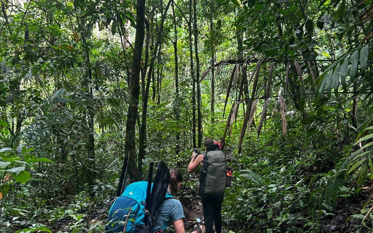
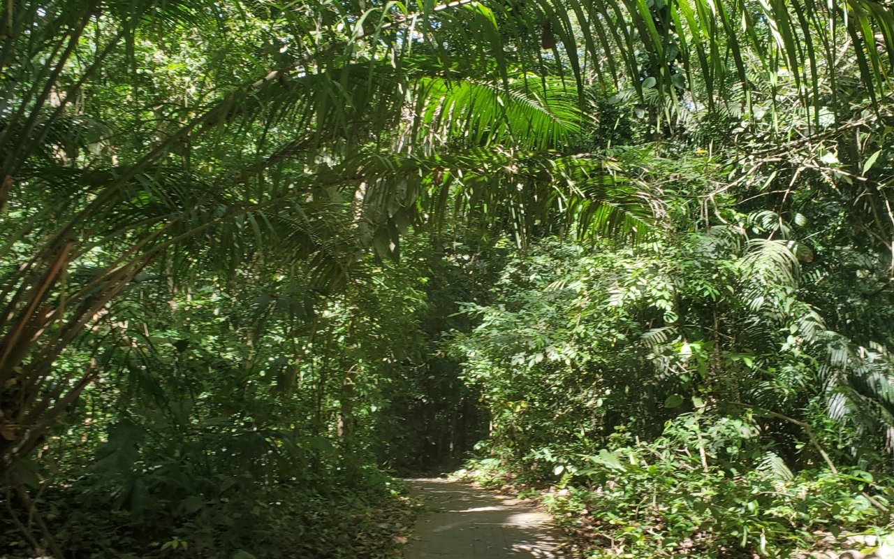
Rainforest walks
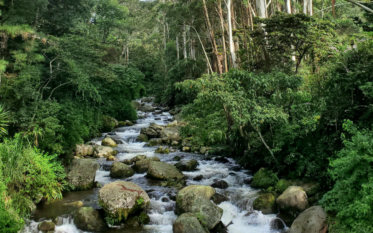
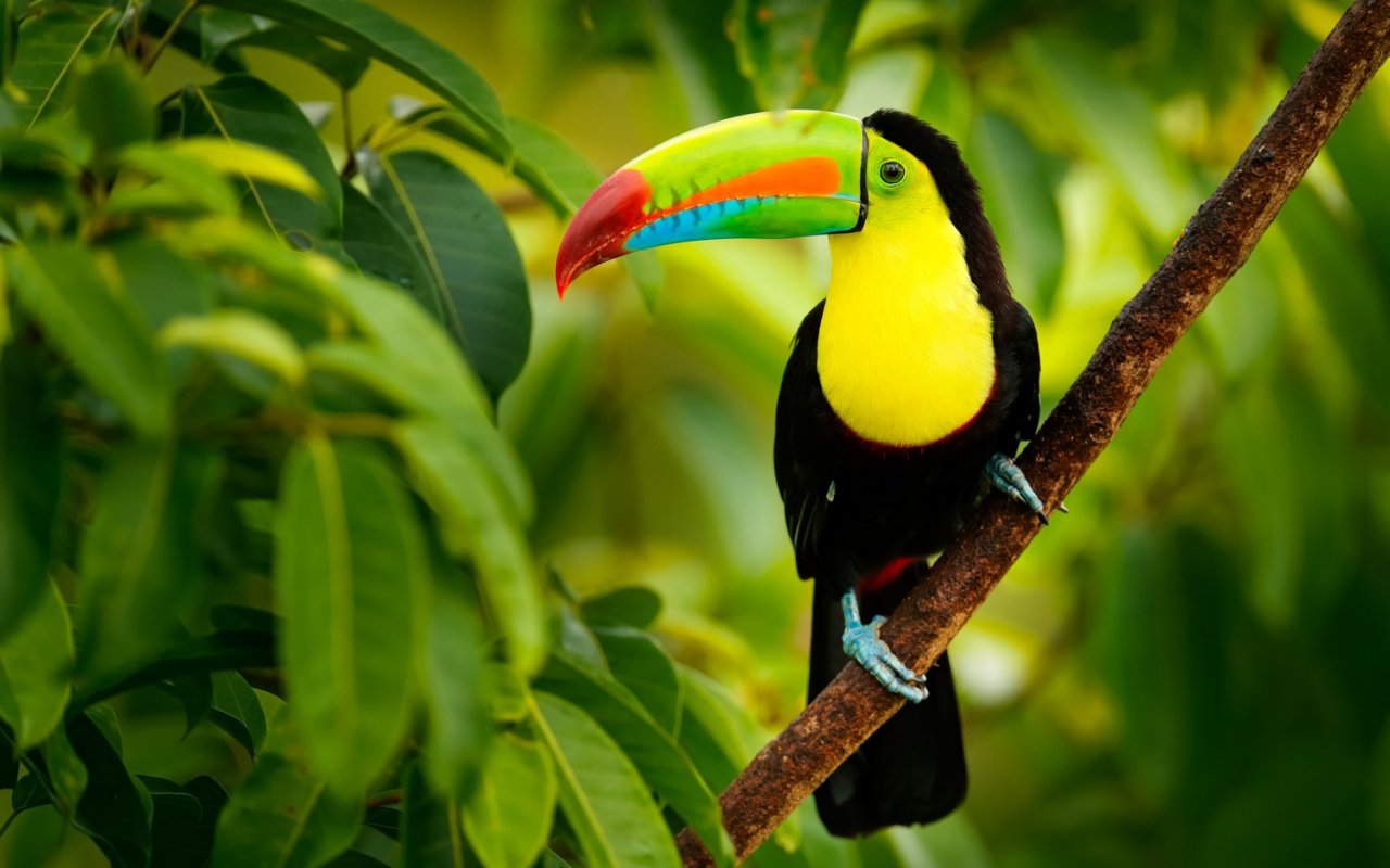
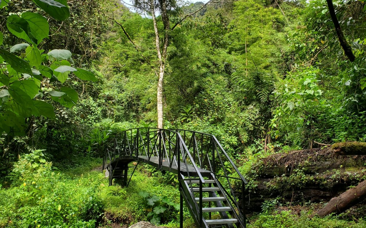
To hike in the Panamanian jungle is to plunge into the heart of a teeming world, where every step echoes with bird song, the rustle of leaves or the cry of a howler monkey. Just a few kilometers from the capital, Soberanía National Park offers this unique immersion in the rainforest.The famous Pipeline Road is a birdwatcher’s paradise: over 400 species have been spotted here, including toucans, parrots and even the elusive harpy eagle. For a shorter, more accessible walk, the Sendero El Charco takes in the lush jungle before arriving at a waterfall ideal for a swim. Finally, the Camino de Cruces, paved by the Spaniards in the 16th century, takes hikers back in time: it was on this path that gold and silver were transported from Peru to the Caribbean coast. Three different experiences, but all marked by the intensity of the rainforest and the imprint of history.
Rainforest treks: technical info
Panama is home to tropical forests just a few kilometers from the capital. These trails allow you to observe dense wildlife while learning about the country’s colonial history. Here are three not-to-be-missed hikes around Panama City
Pipeline Road: a birdwatcher’s paradise
A former oil service road converted into a trail, the Pipeline Road crosses Soberanía National Park for around 17 kilometers. It is one of the world’s best birdwatching spots, with over 500 species of birds recorded. Toucans, macaws, motmots, trogons, tanagers and birds of prey are easy to spot, especially in the early morning. The wide, flat trail allows you to walk along while scanning the canopy. You don’t have to walk all 17 kilometers: many visitors turn back after 5 to 8 kilometers, which is already a 2 to 3-hour round trip. In addition to birds, the Pipeline Road reveals sloths, howler monkeys, agoutis, coatis and iguanas. The heat and humidity can be intense in the middle of the day. Leave at dawn (6am-7am) to take advantage of peak wildlife activity and milder temperatures.Level: easy to moderateLocation: Soberanía National Park, 25 km from Panama CityDistance: up to 17 km (flexible route)Duration: 4 to 6 hours for the whole route, 2 to 3 hours for a portionGuide: recommended to maximize observation and identify species
Sendero El Charco: family walk to a waterfall
This short loop trail in Soberanía National Park leads to a small waterfall where you can take a dip. The 1.5-kilometer route passes through dense tropical forest, with a well-maintained path and signs explaining the local flora. The walk takes between 30 and 45 minutes at a leisurely pace, making it an ideal option for families with children or for a first approach to the tropical jungle. The trail is flat and easy, accessible even in sneakers. The modest but refreshing waterfall provides a welcome bathing break after the walk, and you’ll regularly come across capuchin monkeys, iguanas and a wide variety of butterflies. Weekends can be busier for Panamanian families from the capital. Prefer weekday mornings for greater peace and quiet.Level: easyLocation: Soberanía National Park, 25 km from Panama CityDistance: 1.5 km (loop)Time: 30 to 45 minutesGuide: not necessary, well-marked trail
Camino de Cruces: in the footsteps of the conquistadors
This ancient paved colonial road linked Panama City (on the Pacific side) to Portobelo (on the Atlantic side) as early as the 16th century. The Spaniards used it to transport gold from Peru to ships bound for Europe. The 11-kilometre trail still preserves portions of the original cobblestones, and passes through a tropical rainforest. The hike takes around 6 hours over uneven terrain. Slippery cobblestones, exposed roots and several muddy passages make for technical progress. Humidity is constant under the dense canopy. The Camino de Cruces is as much about history as it is about nature. You can imagine the caravans of mules carrying tons of gold on these very stones 500 years ago. A historian’s guide adds to the experience, recounting battles, pirate attacks and daily life on this strategic route. Without a guide, the trail can be difficult to follow in places, as some of the markers have been obliterated. DifficultylevelLocation: between Panama City and Soberanía National ParkDistance: 11 kmDuration: approx. 6 hoursGuide: highly recommended for historical background and orientation
Preparing your rainforest hike
The Panamanian rainforest has a high level of humidity all year round (70-90%). Even in the dry season, expect to sweat profusely. Carry at least 2 liters of water per person, more for long hikes like the Camino de Cruces. Wear light, quick-drying clothing, a hat, and apply sunscreen and mosquito repellent generously. Leeches are present on some trails in the wet season, particularly on the Camino de Cruces. Put some salt in your bag: it’s the most effective way of getting them off your back. Soberanía National Park is about 25 kilometers from Panama City, or 30 to 40 minutes by car. Entrance to the park costs a few dollars for foreigners. Some trails, such as the Pipeline Road, require prior authorization from the park administration.
Island walks & panoramic views
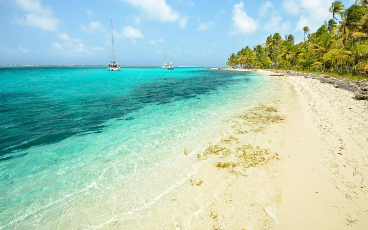
Exploring Panama’s islands means stepping away from the mainland to discover breathtaking panoramas and unspoilt jungles. On TabogaIsland , Cerro La Cruz is an emblematic hike: climbing to the summit, hikers are rewarded with a 360° view of the Pacific Ocean and the Panama City skyline, a striking contrast between nature and city.Further north, in the Bocas del Toroarchipelago , Isla Bastimentos offers a wilder experience. Trails wind through jungle to the famous Red Frog Beach, where golden beaches and capuchin monkeys accompany you on your walk. These island hikes combine adventure, immersion in nature and unforgettable panoramas.
Island treks and panoramic viewpoints: technical info
The Panamanian islands are more than just beaches. There are many trails to explore inland, through coastal jungle and to spectacular ocean vistas. Here is a selection of accessible island hikes
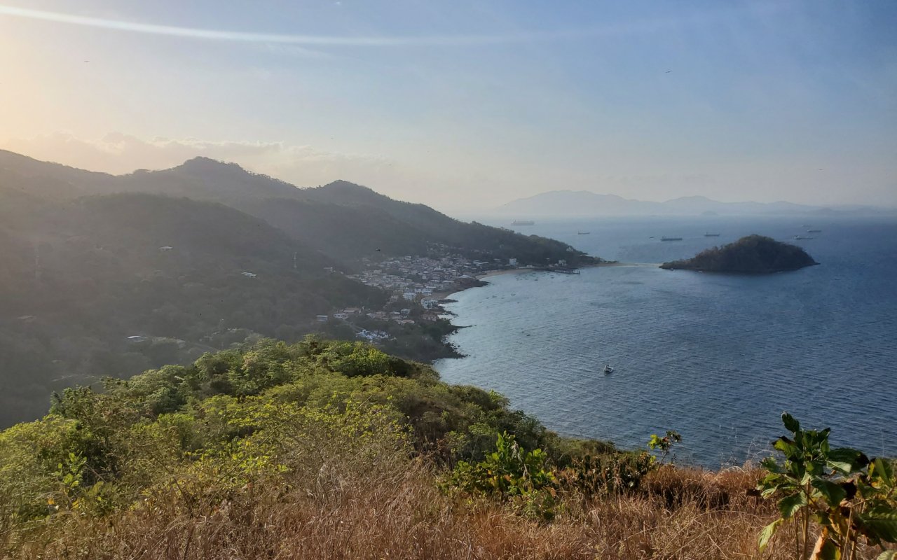
Cerro La Cruz: views of Panama City from Taboga
Taboga Island, nicknamed « Flower Island », is just 20 kilometers from Panama City (45 minutes by ferry). The Cerro La Cruz trail climbs steadily from the village to the island’s summit, the highest point at around 180 m. The 2-kilometre round-trip ascent passes through the colourful village before winding its way through tropical vegetation dotted with bougainvillea and hibiscus. The summit offers 360-degree views: the Panama City skyline to the north, the Pacific Ocean as far as the eye can see, and the neighboring islands to the south. Set off early in the morning to avoid the heat and enjoy the soft light over the bay. The trail is well marked but steep in places. Bring water and shoes with good grip. On Sundays and public holidays, Taboga fills up with Panamanian families from the capital – prefer weekdays for more peace and quiet.Level: easy to moderateLocation: Taboga Island, Gulf of PanamaDistance: approx. 2 km round tripTime: 1 to 2 hoursGuide: not necessary, trail clearly visible from the village
Isla Bastimentos: jungle and wild beaches
Isla Bastimentos, in the Bocas del Toro archipelago, offers several trails through jungle to secluded beaches. The most popular route leads to Red Frog Beach, famous for its small endemic red frogs (*Oophaga pumilio*). The 3 to 5 kilometer trail, depending on the route chosen, passes through dense, humid and sometimes muddy tropical forest. Wooden footbridges, giant roots and lush vegetation create an authentic jungle atmosphere. Three-toed sloths clinging to the trees, basilisks (lizards capable of running on water) and numerous tropical birds are a regular sight. Red Frog Beach rewards the effort with golden sand and waves suitable for bodysurfing. Other trails lead to Wizard Beach or deserted coves. Signage is sketchy, and some junctions can be confusing. A local guide knows the best passages, the areas to avoid at high tide, and can easily spot the red frogs that are often difficult to distinguish in the foliage.Level: moderateLocation: Isla Bastimentos, Bocas del Toro archipelagoDistance: 3 to 5 km depending on trailDuration: 2 to 3 hoursGuide: recommended for orientation and maximizing wildlife observation
Sendero de los Monos: coastal walk on Isla Colón
This coastal trail on Isla Colón, the main island of Bocas del Toro, runs along the north coast between Bocas Town and Bluff Beach. The 4-5 kilometer route alternates between forest and seaside sections, offering views of offshore waves and coastal vegetation. The name « Sendero de los Monos » (Monkey Trail) comes from the troops of capuchin and howler monkeys regularly seen in the trees. The trail remains relatively flat, but crosses several rocky areas and exposed roots. Some sections may be flooded at high tide – check tide tables before setting off. Bluff Beach, the finishing point, is a long, wild beach battered by Atlantic waves. The strong current makes swimming dangerous, but it’s a popular surfing spot. Several small beach restaurants offer refreshments. The return journey can be made on foot along the same path or by water cab from Bluff Beach.Level: easy to moderateLocation: Isla Colón, Bocas del ToroDistance: 4 to 5 km (one way)Duration: 1h30 to 2 hoursGuide: not necessary, but check the tides before setting off
Cerro Ancón: a green lung in the heart of Panama City
Cerro Ancón (199 m) is the hill that dominates Panama City, visible from all over downtown thanks to the giant Panamanian flag at its summit. The paved trail climbs for around 2.5 kilometers through a protected urban forest, a surprising refuge for wildlife in the middle of the capital. The gradual ascent takes around 45 minutes to 1 hour. Along the way, you’ll come across sloths, iguanas, agoutis, toucans and macaws. The summit offers a panoramic view of Panama City: Casco Viejo to the west, the modern skyline to the north, the Panama Canal and the Bridge of the Americas to the south. It’s the best free vantage point for photographing the city, and you should set off early in the morning (before 8 a.m.) or late in the afternoon to avoid the heat. The trail is safe during the day, but avoid going alone at dawn or dusk. On weekends, many Panamanian families come to walk it, creating a friendly and safe atmosphere.Level: easyLocation: Panama City, Ancón districtDistance: approx. 2.5 km round tripTime: 1 to 1h30Guide: not necessary
Isla Iguana: island tour and beaches
Isla Iguana, a marine wildlife refuge off Pedasí, offers an easy trail that crosses the island from east to west. The 1.5-kilometre route links Playa El Cirial (the main beach) with Playa El Faro (a more secluded secondary beach), and passes through a dry tropical forest inhabited by the black and green iguanas that give the island its name, as well as thousands of hermit crabs that literally invade the ground. Craters testify to the island’s use as a bombing zone by the US army during the Second World War – stay on the path as a precaution. Playa El Faro, on the west side, has stronger currents and waves, unlike the protected main beach. It’s a good spot for snorkeling along the rocks. A complete tour of the island takes around 45 minutes to 1 hour. Don’t forget that the island has no infrastructure: bring water, food and sun protection.Level: easyLocation: Isla Iguana, off Pedasí (Azuero peninsula)Distance: approx. 1.5 km (island crossing)Duration: 45 minutes to 1 hourGuide: not necessary, but usually included in boat excursions
Tips for island hikes
The Panamanian islands are exposed to direct sunlight, especially on coastal paths with no shade. Apply sunscreen generously, wear a wide-brimmed hat and sunglasses. Hydration is crucial: carry at least 1.5 liters of water per person, more during the day. Tide times influence some coastal trails. Ask before you go, especially for the Sendero de los Monos in Bocas del Toro. Most of the islands have no pharmacy or medical services – so pack a first-aid kit with bandages, disinfectant and basic medicines. Ferries to Taboga leave several times a day from the Balboa terminal in Panama City. For Bocas del Toro, daily flights connect the capital in 1 hour, or bus + boat via Almirante (8 to 10 hours in total). Isla Iguana can be reached by boat from Pedasí (20-30 minute crossing).
Waterfalls & unspoilt nature
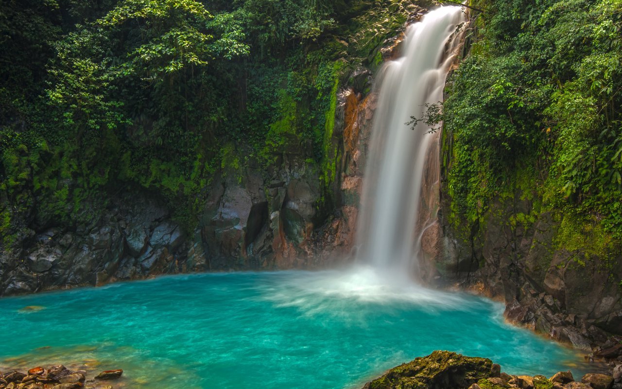
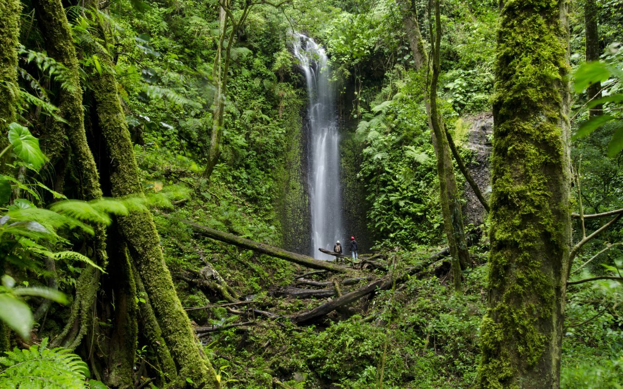
Panama abounds in trails that lead to hidden waterfalls and unspoilt nature, providing a refreshing oasis after a day’s walking. In Boquete, the Lost Waterfalls invite you on a magical hike through the rainforest, punctuated by the discovery of three successive waterfalls where bathing becomes an unforgettable pleasure.In El Valle de Antón, the Sendero de la Piedra Pintada blends culture and nature: the trail crosses the forest to reach waterfalls and ancient petroglyphs, witnesses of pre-Columbian history. Not far away, the Chorro Macho and Pozos Termales offer short but invigorating walks, with natural pools perfect for relaxing. In the province of Veraguas, the Bermejo waterfall reveals itself along lush green paths, while in Bocas del Toro, the Klosay waterfall completes the range of aquatic hikes with its refreshing waters and wild setting. Last but not least, the Santa Fé waterfalls reveal numerous paths to impressive waterfalls, accessible to hikers eager for wild landscapes and adventure.
Waterfall treks and unspoilt natural sites: technical info
Panama boasts dozens of waterfalls nestled in tropical forests, volcanic craters and mountainous regions. These sites offer coolness, swimming and spectacular scenery. Here is a selection of waterfalls within easy walking distance
The Lost Waterfalls: three hidden waterfalls in Boquete
This network of private trails leads to three successive waterfalls in a dense tropical forest near Boquete. The 5-kilometre route winds through an unspoilt estate where lush vegetation creates a primordial jungle atmosphere. The first waterfall (approx. 25 metres high) is easily reached in a 30-minute walk along a well-maintained path. There’s a natural pool where you can bathe in cool, clear water. The second cascade, a further 15 minutes away, offers a similar setting with a more powerful flow. The third cascade requires a technical descent over slippery rocks with assistance ropes. It is reserved for hikers at ease on uneven terrain. The return journey takes the same route, bringing the total time to 2-3 hours for all three cascades. Access is subject to a fee (around 5-10 dollars) and includes use of the groomed paths. In the rainy season (May to November), the flow increases considerably, but the trails become muddy and slippery – this hike is not recommended at this time. Bring a bathing suit, towel and shoes that can get wet.Level: moderate (technical for the 3rd cascade)Location: Boquete, Chiriquí provinceDistance: 5 km round tripTime: 2 to 3 hoursGuide: not necessary, marked trailsSpecial feature: avoid in rainy season
Sendero de la Piedra Pintada: petroglyphs and waterfall
This easy trail in the El Valle de Antón valley combines pre-Columbian history and nature. The 2-kilometre route leads first to the Piedra Pintada (Painted Stone), a rock several metres high covered with petroglyphs dating back 500-1000 years. The engravings depict geometric figures, animals and symbols whose exact meaning remains a mystery. The trail then continues to a small waterfall nestled in the forest. The shallow pool is suitable for children and offers welcome refreshment. The dense vegetation around the waterfall is home to colorful frogs, butterflies and numerous birds, and the well-marked path leads through local plantations and alongside a river. Signs explain (in Spanish) the history of the petroglyphs and the volcanic geology of the area. This is an excellent family hike combining culture and nature in less than two hours.Level: easyLocation: El Valle de Antón, Coclé provinceDistance: 2 km round tripDuration: 1 to 1h30Guide: not necessary
Chorro El Macho and hot springs: a double experience
El Valle de Antón offers this unique combination of cold waterfall and hot springs. The 1-2 km access trail descends gradually to Chorro El Macho, a 35-metre waterfall that flows into a large natural pool. The cold mountain water contrasts pleasantly with the ambient heat. You can bathe at the foot of the waterfall or simply admire the curtain of water from the surrounding rocks. The Pozos Termales are nearby, accessible via a parallel path. These natural hot-water pools (approx. 38°C) of volcanic origin are ideal for bathing. Alternate between a cool dip in the waterfall and a relaxing dip in the hot springs for a complete spa experience. Access is subject to a small fee, and facilities include changing rooms and toilets. On weekends, Panamanian families flock here – prefer weekday mornings for greater peace and quiet.Level: easyLocation: El Valle de Antón, Coclé provinceDistance: 1 to 2 kmDuration: 30 to 45 minutes (not including bathing time)Guide: not necessary
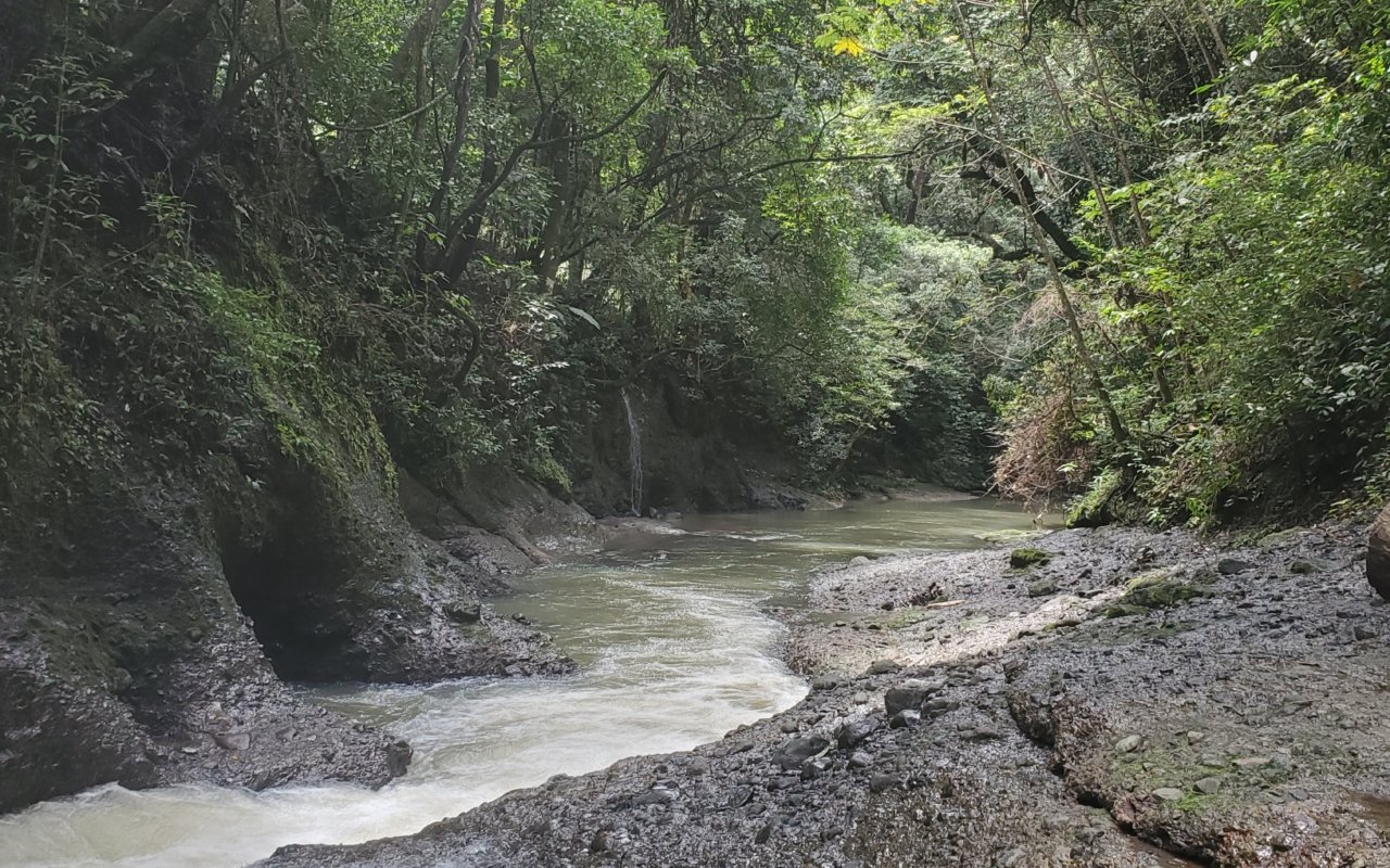
Bermejo waterfall: Santa Fé’s hidden gem
The mountainous region of Santa Fé, still little visited by tourists, hides several spectacular waterfalls, including the Bermejo waterfall. The 2 to 4 kilometer trail (depending on the starting point) passes through coffee and cocoa plantations before plunging into a primary forest. The Bermejo waterfall falls more than 50 meters into a rocky canyon. The deep pool at its foot is perfect for swimming, and the water remains cool all year round thanks to the altitude (around 500 metres). The rock faces, covered with moss and ferns, create an impressive natural amphitheatre. The trail sometimes passes through private property – a local guide facilitates access and knows the best viewpoints. Signage is sketchy, and there are a number of confusing junctions. As Santa Fé is a less developed destination, the experience remains authentic and untouristy. The region is also home to other waterfalls (El Salto, La Tulivieja) that you can combine on a full-day trip with a guide. Bring sturdy hiking boots, as some passages cross rivers.Level: moderateLocation: Santa Fé, province of VeraguasDistance: 2 to 4 km depending on departureTime: 1 to 2 hoursGuide: recommended for orientation and access to private property
Klosay waterfall: Ngäbe-Buglé territory
This waterfall is located on the territory of the Ngäbe-Buglé indigenous community in the Bocas del Toro archipelago. Access is only possible with a local guide from the community, respecting the traditions and ancestral territory of the community. The trail of around 1 to 2 kilometers passes through dense forest before reaching the waterfall, which falls some 15 metres into a natural basin. The clear water allows you to see the rocks at the bottom. The guide, usually a member of the Ngäbe-Buglé community, explains the medicinal plants traditionally used and shares aspects of the local culture. This tour is as much a cultural experience as a nature hike. The price usually includes the guide, access to the territory and sometimes a traditional meal, and can be booked from Bocas Town through local agencies or directly with the community. Follow the guide’s instructions on accessible areas and cultural practices.Level: easyLocation: Bocas del Toro, Ngäbe-Buglé territoryDistance: 1 to 2 kmDuration: 30 minutes to 1 hourGuide: mandatory (indigenous territory)
Tavida waterfalls: hiking in primary forest
Near the village of El Copé, in the province of Coclé, the Tavida waterfall system offers an unspoilt rainforest experience. The 3 to 4 kilometer trail crosses the Omar Torrijos National Park, a protected area with exceptional biodiversity, and leads to several successive waterfalls, the most spectacular measuring around 40 meters. The trail follows the Tavida River, crossing the stream several times on tree trunks or stones. The dense forest is home to a remarkable array of wildlife, including howler monkeys, toucans, quetzals and brightly-colored poison frogs. Birdwatchers particularly appreciate this site for the diversity of species they can observe. Access from El Copé requires a 4×4 vehicle or an additional 2 km walk from the main road. Few tourists visit this site, which guarantees calm and authenticity. Difficultylevel: moderateLocation: Omar Torrijos National Park, near El Copé, Coclé provinceDistance: 3 to 4 km round tripDuration: 2 to 3 hoursGuide: recommended for orientation and wildlife observation
Los Cangilones de Gualaca waterfall: canyon and natural pools
This unique site in Chiriquí province combines waterfall and canyon sculpted by water. The river has carved narrow gorges in the volcanic rock, creating a succession of deep natural pools with turquoise waters. The easy 500-metre path from the parking lot leads to the edge of the canyon. You can swim in the various pools or jump off the rocks (check the depth beforehand). The smooth canyon walls reach heights of 10-15 m. At weekends, local families come to picnic and swim – the atmosphere is friendly and festive. On weekdays, the site is quieter. The main waterfall upstream requires an additional 1 km walk over uneven terrain, and local vendors offer food and drink at the entrance. Access is free or for a small voluntary contribution towards the upkeep of the site. This is an ideal half-day excursion from David or Boquete.Level: easyLocation: Gualaca, Chiriquí provinceDistance: 500 m to 1.5 km depending on objectiveTime: 30 minutes to 1 hour walkGuide: not necessary
Tips for water hikes
Always check the weather forecast before setting off for a waterfall. Rainfall upstream can cause the water level to rise rapidly, even if the sky is clear on the spot. In the rainy season, favour easily accessible waterfalls and avoid venturing into narrow canyons or gorges. Bring a bathing suit, towel and sturdy water shoes or hiking sandals. The rocks around waterfalls are often slippery due to moss and constant humidity. A waterproof bag protects your phone, camera and dry clothes. Never dive into a pool without checking its depth and the absence of rocks below the surface. Diving accidents in shallow areas are the main cause of serious injury on these sites. The water in mountain waterfalls remains cool all year round (18-22°C). Make sure you bring a towel and warm clothes for after a swim, especially at higher altitudes such as Boquete, where temperatures drop in the late afternoon.
Wilderness hiking
For lovers of wide-open spaces and unspoilt nature, Panama offers hiking in regions that are still very much unspoilt. La Amistad International Park, on the border with Costa Rica, is a veritable sanctuary of biodiversity. Trails wind through dense rainforests and mountainous areas, offering hikers the chance to discover exceptional flora and fauna, far from the crowds and mass tourism. These deep hikes offer total immersion in a wild Panama, where every step reveals a new ecosystem and a unique landscape.
Hiking in wilderness and remote areas
Panama is home to little-explored territories where nature reigns supreme. These regions require serious preparation, appropriate equipment and often the compulsory accompaniment of a guide. They are ideal for experienced hikers in search of deep immersion and authentic adventure
La Amistad International Park: cross-border cloud forest
La Amistad International Park covers 407,000 hectares straddling the border between Panama and Costa Rica. It is Central America’s largest mountain rainforest reserve, designated a UNESCO World Heritage site in 1990. The park protects an exceptional ecological diversity, from tropical lowlands (100 m) to Andean peaks (3,549 m at Cerro Fábrega). Trails vary from 5 to 20 kilometers depending on the itinerary chosen. The most accessible hike starts from the Las Nubes sector (Cerro Punta side) and passes through a cloud forest perpetually shrouded in mist. The El Retono trail (8 km, 4-5 hours) leads to a viewpoint overlooking the canopy and surrounding mountains. Longer tours (2-4 days) take you deep into almost untouched areas, home to jaguars, pumas, tapirs and over 600 species of birds. Nights are spent in tents or rudimentary refuges. The mountain climate is unpredictable: rain, fog and cool temperatures (5-15°C) even in the dry season. Access to the park requires prior authorization from the ANAM (environmental authority). A certified guide is mandatory for all hikes beyond the first few kilometers. He or she knows the often overlooked trails, manages logistics and ensures safety in changing conditions.Level: moderate to difficultLocation: Chiriquí province, border with Costa RicaDistance: 5 to 20 km depending on circuit (up to several days)Duration: 3 to 8 hours for one-day circuitsGuide: compulsorySpecial features: ANAM authorization required, mountain equipment necessary
Darién National Park: the last wild jungle
Darien represents one of the last wild frontiers in the Americas. This 579,000-hectare park, Panama’s largest, stretches along the Colombian border. Classified as a UNESCO World Heritage site, it is home to extraordinary biodiversity and indigenous Emberá and Wounaan communities living according to their ancestral traditions. Hiking in the Darién is not something you can improvise. Access is usually by boat from La Palma or Yaviza, up the Chucunaque, Tuira or Balsas rivers by motorized pirogue. Tours lasting from 3 to 7 days combine river navigation with walks through dense forest. The most classic trail leads to Cerro Pirre (1,615 m), a mountain dominating the jungle. The 12-15 km ascent from the village of Rancho Frío takes two days, and includes a bivouac in the forest. At the summit, the view embraces the Pacific Ocean and the green immensity of the Darién. The heat (30-35°C), constant humidity (80-90%), leeches, mosquitoes and dense vegetation make the climb physically demanding. Trails are often non-existent – you advance by machete. An Emberá or Wounaan guide is essential: he opens the road, identifies dangers (venomous snakes, spiders), finds drinking water and liaises with the communities. The region remains unstable near the Colombian border. Consult the consular recommendations before you leave, and make sure you are accompanied by a reputable agency with experienced local guides. Darién is not a destination for beginners, but an exceptional experience for seasoned hikers.Level: very difficultLocation: Darién province, Colombian borderDistance: 3 to 7-day circuits, 10 to 20 km walking per dayDuration: minimum 3 days, generally 5 to 7 daysGuide: mandatory, with local indigenous guideSpecial features: special permits required, check security situation, excellent physical condition essential
Sendero Tranquila to Bocas del Toro: multi-day trek
This little-known trail crosses the island of Bastimentos from north to south for around 15 kilometers. Unlike the day hikes to Red Frog Beach, the Sendero Tranquila goes deep into the interior of the island, an area that is still wild and little frequented. The complete trek takes 2 to 3 days, depending on your pace. The trail passes through a variety of ecosystems: coastal mangroves, dense tropical forest, swamps and rocky areas. The trail passes through isolated Ngäbe-Buglé villages, where you can sometimes stay with local people for a fee. Orientation is complex: several forks in the trail, paths obliterated by vegetation, passages flooded in the rainy season. A local guide knows the shortcuts, drinking water points and safe places to camp. Bring camping gear, mosquito net, water filter, food for 3 days and waterproof bag. No tourist infrastructure along the way. This hike reveals the authentic Bocas del Toro, far from the beach bars and tourist excursions.Level: difficultLocation: Isla Bastimentos, Bocas del Toro archipelagoDistance: approx. 15 km (2-3 day trek)Duration: 2 to 3 daysGuide: highly recommended for orientation and community relationsSpecial features: complete autonomy required, wilderness camping or staying with local people
Chagres National Park – Cerro Azul / Jefe sector: high rainforest
The eastern sector of Chagres National Park, accessible from Cerro Azul, offers hikes in the high rainforest (800-1,000 m altitude) that are much less frequented than the circuits near Panama City. Cerro Jefe (1,007 m), the region’s highest peak, can be climbed in 6-8 hours round trip from the village of Cerro Azul. The steep trail crosses several vegetation levels: fog forest, rocky areas, shrubby vegetation near the summit. On a clear day, the view takes in both the Atlantic and Pacific oceans. Longer tours (2-3 days) explore the forest ridges where harpy eagles, toucans, trogons and hummingbirds nest. At night, you can hear the howling of monkeys and the calls of nocturnal birds. Wilderness camping is permitted with an ANAM permit, and can be accessed from Cerro Azul, a residential village 45 minutes from Panama City. Trails are poorly marked and sometimes overgrown. A naturalist guide turns the hike into a real rainforest school: identification of medicinal plants, animal tracks, ecosystems, etc. This area remains cool all year round (15-22°C) thanks to the altitude. Bring warm evening clothes, a waterproof jacket and good hiking boots. Fog can fall quickly, reducing visibility to a few meters.Level: moderate to difficultLocation: Chagres National Park, Cerro Azul sectorDistance: 8 to 15 km depending on circuitDuration: 6 to 8 hours for Cerro Jefe, 2-3 day circuits possibleGuide: recommended for orientation and naturalistic observationSpecial features: ANAM permit for camping, cool mountain climate
Comarca Ngäbe-Buglé: immersion in indigenous territory
The Comarca Ngäbe-Buglé, an autonomous indigenous territory in the provinces of Bocas del Toro, Chiriquí and Veraguas, offers hiking opportunities off the beaten tourist track. Access to this territory requires respect for community rules and the accompaniment of an authorized guide. 3 to 5-day tours take you from village to village, through mountains, rivers and forests. Guests sleep in traditional houses on stilts, share meals (rice, beans, fish, plantain) and participate in daily chores. Trails often follow old hunting trails or link villages together. The terrain is rugged: steep climbs, river fords, dense forest. Daily distances vary from 10 to 20 kilometers, depending on the topography. The Ngäbe-Buglé guides share their knowledge of the forest: medicinal plants, hunting techniques, legends and the history of their people. It’s a deep cultural immersion as much as a nature hike. Respect for traditions is paramount: always ask before photographing, accept the hospitality offered, pay guides and host families fairly. These treks are organized via agencies specialized in community tourism or directly with the communities. Part of the income is used to finance education and health in the villages.Level: moderate to difficultLocation: Comarca Ngäbe-Buglé (provinces of Bocas del Toro, Chiriquí, Veraguas)Distance: 10 to 20 km per day over 3 to 5 daysDuration: 3 to 5 days minimumGuide: compulsory (Ngäbe-Buglé guide authorized)Special features: cultural immersion, accommodation with local people, strict observance of local customs
Preparation for wilderness trekking
Panama’s wilderness areas require careful preparation. Consult a doctor before departure for vaccinations (yellow fever, hepatitis A and B, typhoid) and malaria prophylaxis, depending on the area. Take along a complete medical kit including antibiotics, antidiarrheals, antihistamines and disinfectant. Equipment should be sturdy and tried-and-tested: tried-and-tested hiking boots, 50-70L rucksack, tropical tent with mosquito net, lightweight sleeping bag, water filter or purifying tablets, headlamp, GPS or paper map, multi-purpose knife, survival kit.
Bring quick-drying technical clothing: long pants (to protect against leeches and mosquitoes), long-sleeved shirts, hat, waterproof poncho, spare socks. Cotton clothing retains moisture and promotes chafing – prefer synthetic or merino materials. Always inform someone of your detailed itinerary and return date. In these remote areas, it can take several days for help to arrive. Communication is often impossible: no telephone network. Some agencies use satellite telephones for emergencies. Scrupulously respect the « Leave No Trace » principles: take all your garbage with you, don’t pick plants, don’t disturb wildlife, camp on established sites. These fragile ecosystems deserve our protection for future generations.